
The Wildlands Network has announced the launch of an extensive wildlife research initiative along a key desert transportation corridor on State Route 62 in Southern California. The upcoming field study is designed to track and analyze animal movement patterns across the desert terrain between Yucca Valley and Palm Springs, providing vital ecological insight into how native wildlife species navigate the heavily traveled roadway.
The scientific assessment is being deployed in preparation for the construction of two dedicated wildlife crossings planned over State Route 62, located east of the Victor Valley. By conducting structured ecological monitoring prior to construction, project organizers aim to gather essential behavioral and spatial data to help optimize the placement, design, and long-term utility of the proposed overpasses.
Researchers will utilize non-invasive wildlife survey techniques to minimize disturbance to local animal populations while capturing critical demographic and movement data. The investigative work centers on tracking key native species, specifically mountain lions, desert bighorn sheep, and bobcats, as part of an expansive effort to evaluate the benefits of crossing structures and enhance survival conditions for wildlife across the Mojave Desert.
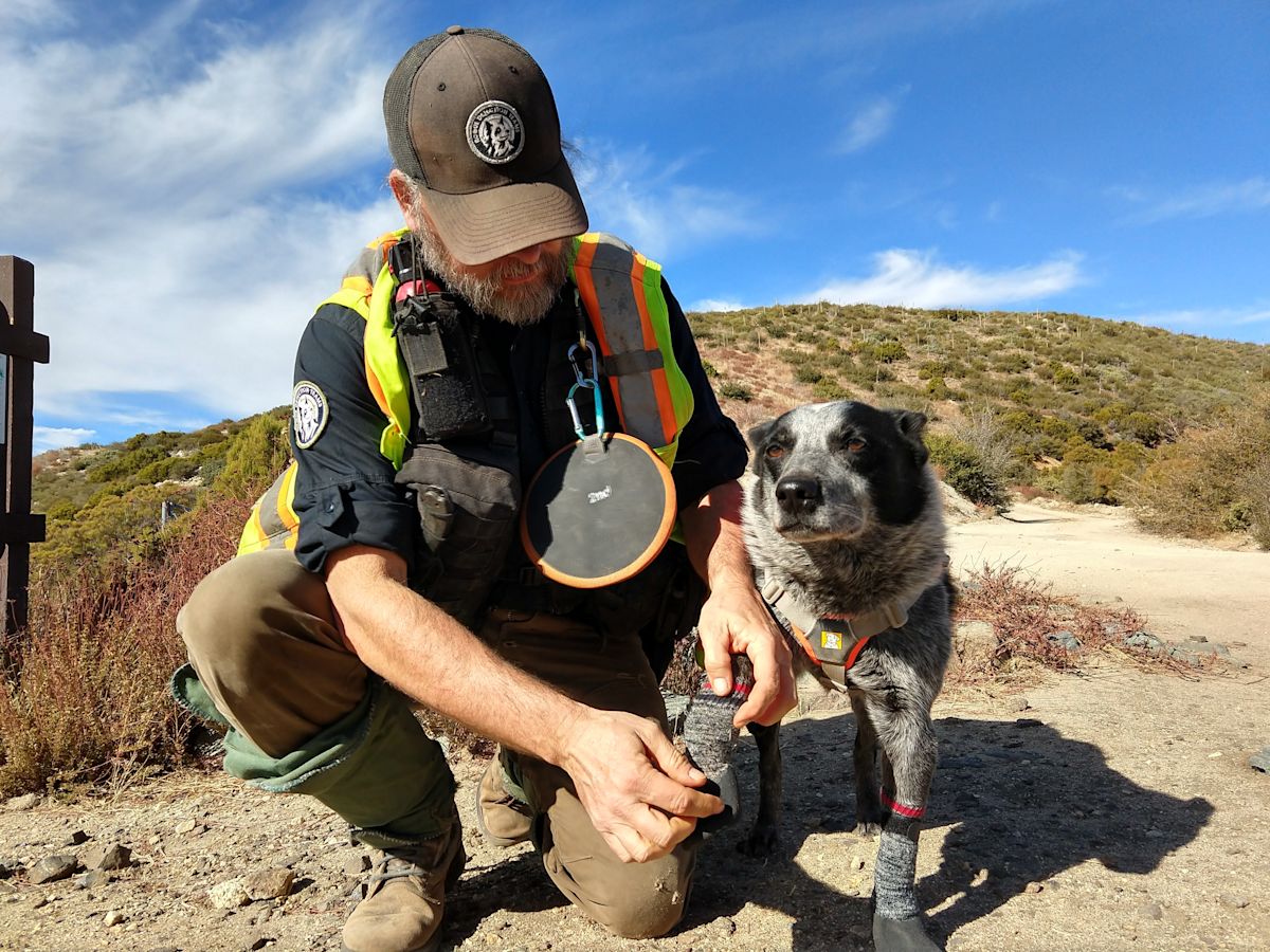
A central element of the field investigation involves the deployment of specialized scent-detection teams. These units pair highly trained rescue dogs with professional field biologists who hold an advanced understanding of animal tracking, behaviors, and environmental signs. Working together, the canine and human handlers will search terrain adjacent to the highway to locate fecal droppings, or scat, deposited by elusive predators such as bobcats and mountain lions.
Simultaneously, a distinct research group will conduct targeted surveys for desert bighorn sheep. This specialized team possesses years of background studying the unique habits of desert bighorn populations, including their local movement corridors, habitat selection, and genetic profiles throughout the challenging expanses of the Mojave Desert.
Following field collection, scat samples will be sent to specialized laboratory facilities for detailed genetic analysis. Technicians will extract DNA to identify individual animals, generating the baseline datasets necessary to evaluate animal movements and measure the degree of genetic exchange currently taking place across the highway corridor.
Field operations have been organized into two scheduled tracking sessions. The specialized desert bighorn sheep surveys are scheduled to take place on September 25, operating from 9 a.m. to noon. Following that initial effort, the Rogue Detection Teams will carry out their dog-assisted searches for predator scat on October 6, also running between 9 a.m. and noon.
Conservation leaders noted that documented wildlife fatalities, independent ecological research, and reports from public agencies have collectively highlighted the pressing need for safe crossing options on this busy desert route. In addition to protecting human drivers, the survey work and future overpasses are designed to safeguard mule deer, mountain lions, bighorn sheep, and bobcats by restoring landscape permeability.
Maintaining ecological connectivity across State Route 62 is considered essential for sustaining resilient wildlife populations over the long term. Biologists emphasize that when wide-ranging animals are cut off by major infrastructure, fragmented populations become increasingly vulnerable to localized genetic inbreeding and the rapid spread of disease.
The findings from these surveys will serve a dual purpose for highway planners and wildlife managers. Beyond directly informing the engineering and layout of the two overpasses, the study will establish a comprehensive pre-construction baseline, documenting exactly how wild animals interact with the roadway both before and after the crossing structures are built.
This collaborative, long-term wildlife monitoring initiative is supported by dedicated grant funding from state and regional conservation partners. Financial backing for the planning and research phases of the crossing structures has been provided by the Wildlife Conservation Board alongside the Coachella Valley Mountains Conservancy.
The urgency surrounding the overpass initiative comes after a decade of steadily intensifying traffic volumes on State Route 62. Land trust representatives report that vehicle numbers have surged in recent years, driven by sustained population growth throughout the Morongo Basin as well as a threefold rise in visitor travel to nearby Joshua Tree National Park.
This sharp rise in vehicle traffic has created dangerous conditions for regional wildlife attempting to cross the highway. The planned overpass locations were selected specifically to address hazardous collision zones at the Morongo and Yucca grades, where multiple animal deaths—including collisions involving mountain lions, black bears, bighorn sheep, and deer—were recorded within the span of a single year.
Preliminary designs for the proposed crossing structures incorporate natural materials to encourage animals to use them safely. The overpasses will be constructed with an earthen foundation and replanted with native desert flora identical to the plant communities found in the surrounding landscape, providing a continuous natural pathway.
To further ensure wildlife safety and guide animals toward the elevated spans, the project will incorporate continuous directional fencing along both sides of State Route 62. The final infrastructure design will also include specialized mitigation features engineered to dampen traffic noise and block intrusive vehicle headlight glare from the highway below.


(0)