
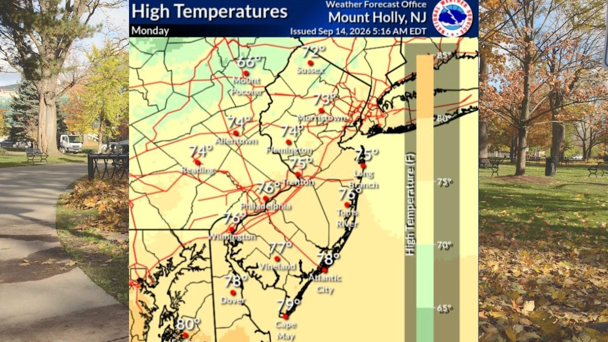
Residents across New Jersey are experiencing a stretch of tranquil and comfortable weather as Tuesday brings abundant sunshine, low humidity levels, and temperatures comfortably resting in the 70s. The pristine conditions mark the beginning of a multi-day period of dry weather that meteorologists expect to hold firm across the Garden State through at least Thursday.
Tuesday’s daytime highs are forecast to reach the mid-to-upper 70s across the vast majority of the state, creating ideal conditions for outdoor pursuits and daily commutes. The only minor deviation will be observed in New Jersey's northwestern counties, where slightly higher elevations and local terrain will keep maximum daytime readings limited to the low 70s.
The prevailing calm atmosphere is underpinned by dry air that will dominate the local environment over the next few days. For residents seeking prolonged stretches of rain-free weather, the immediate horizon offers ample opportunity to enjoy clear skies and mild breezes without the disruption of unexpected precipitation.
As the week progresses, a noticeable atmospheric transition will begin to take shape starting Wednesday. Forecasters indicate that temperatures will steadily climb into the low-to-mid-80s across most communities, accompanied by a gradual rise in atmospheric moisture that will make the air feel somewhat more humid compared to the crisp start of the week.
Despite the creeping humidity and warmer thermal readings, Wednesday is slated to retain plenty of sunshine from coast to inland corridors. The mostly sunny pattern will provide bright daytime conditions while pushing afternoon highs several degrees above early autumn averages.
Thursday will mirror Wednesday’s warm pattern, sustaining highs in the low-to-mid-80s alongside mostly sunny skies. The persisting warmth and sun will provide another pleasant afternoon, though atmospheric shifts will gradually prepare the region for an approaching boundary late in the day.
Meteorologists from the National Weather Service report that a cold front is projected to approach and traverse the state starting Thursday night and lingering into Friday morning. This frontal boundary will serve as the first real test to the extended dry spell that has encompassed the region throughout the working week.
However, the passage of the front is not expected to produce widespread or heavy precipitation. Current National Weather Service guidance indicates that while a few isolated or scattered showers could develop over select portions of New Jersey, large sections of the state are likely to dodge the rain entirely and remain dry.
Once the frontal boundary moves through, Friday is shaping up to deliver another largely dry and bright day. High temperatures are projected to rebound once again into the low-to-mid-80s under mostly sunny skies, offering a warm and pleasant conclusion to the traditional workweek.
The upcoming weekend will introduce a subtle shift in the regional weather pattern, beginning with an exceptionally pleasant Saturday. Temperatures will ease back down into the comfortable 70s, complemented by mostly sunny skies that should make for excellent outdoor conditions across all twenty-one counties.
The tranquil weather is expected to encounter disruptions by Sunday as atmospheric cloud cover increases from the west and south. The thickening cloud deck will signal the approach of a more unsettled weather system that threatens to interrupt the late-weekend calm.
By Sunday afternoon and extending through Sunday night into Monday, the probability of precipitation will climb across New Jersey. Forecasters are currently tracking a potential round of showers accompanied by embedded thunderstorms that could affect local travel and outdoor events.
Weather forecasters have highlighted a degree of uncertainty regarding the exact timing, path, and strength of the late-weekend storm system. Because numerical computer models continue to evaluate the interaction of various atmospheric variables, meteorologists stress that the weekend evolution could adjust slightly in subsequent updates.
Despite the inherent uncertainty surrounding the Sunday and Monday storm prospects, forecasters have emphasized that severe weather is not currently expected to develop. Any thunderstorms that do materialize are anticipated to remain general in nature, producing standard rain showers rather than hazardous or destructive conditions.
The shifting weather patterns arrive alongside the gradual progression of the autumn foliage season across the state. Early seasonal forecasts indicate that leaf colors this year may appear somewhat dull in certain pockets of New Jersey, while other areas are still on track to exhibit vibrant and good fall displays.
With a blend of late-summer warmth in the 80s, crisp interludes in the 70s, and a predominantly dry forecast through Friday, New Jersey residents have a favorable window to take advantage of the outdoors before preparing for cloudier skies and possible rain toward the close of the weekend.




(0)